Learning from Oak primary geography (1)
Written June 2026
It’s been on my radar to go for a long time but recently I sat down to look through the geography resources of Oak National, written in partnership with the Geographical Association. It’s rare (perhaps unique?) to have such a thorough package of resources and accompanying materials available for free and so I wanted to take a detailed look and think about the approach and resources shared. What could I learn from the approach used here? How does this approach challenge my thinking and what I believe is best practice? What ideas could I take from this curriculum and the resources?
It made sense to start at the beginning and delve into the primary resources first. In this first blog, I’ll consider what secondary geography teachers can learn from the primary geography resources of Oak National and focus on fieldwork and geographical skills.
The first thing that’s obvious when you look through the Oak National resources for Key Stage 1 and Key Stage 2 is that fieldwork and the importance of fieldwork as a geographer sits at the heart of this curriculum offering. In contrast to many geography resources of the past, the body of knowledge that underpins (and is thus required for high-quality) fieldwork has also been clearly debated, decided, and sequenced. In the resources, this fieldwork knowledge is then explicitly taught, and nothing is left to chance. This might sound obvious but, in my experience, it’s actually quite rare. So much written about and shared with regards to ‘high quality’ fieldwork talks about the logistics of how to deliver it but lacks the knowledge grounding: what is it we’re actually trying to teach students through doing this fieldwork? How is this experience / knowledge helping them to become better at geography?
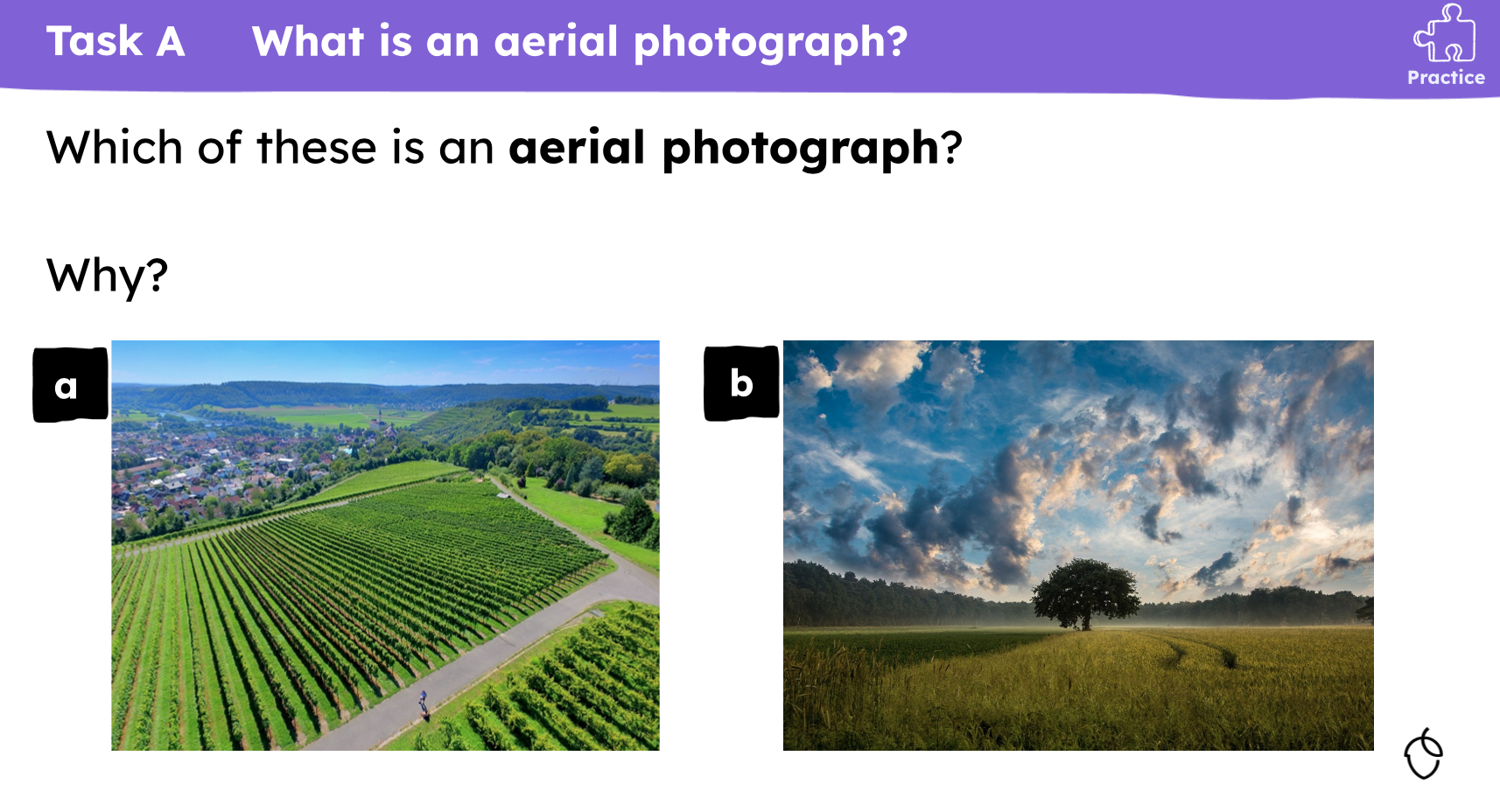
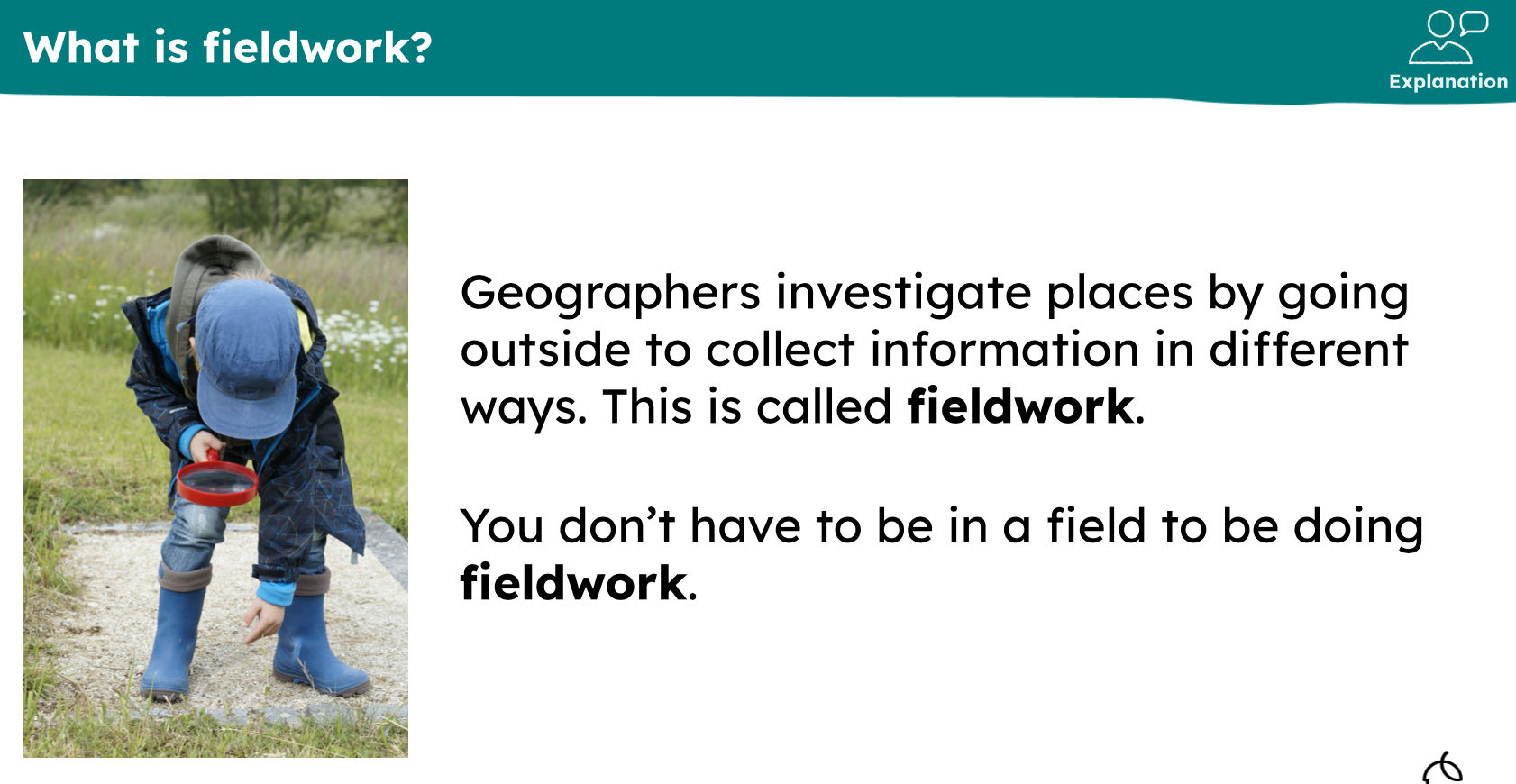
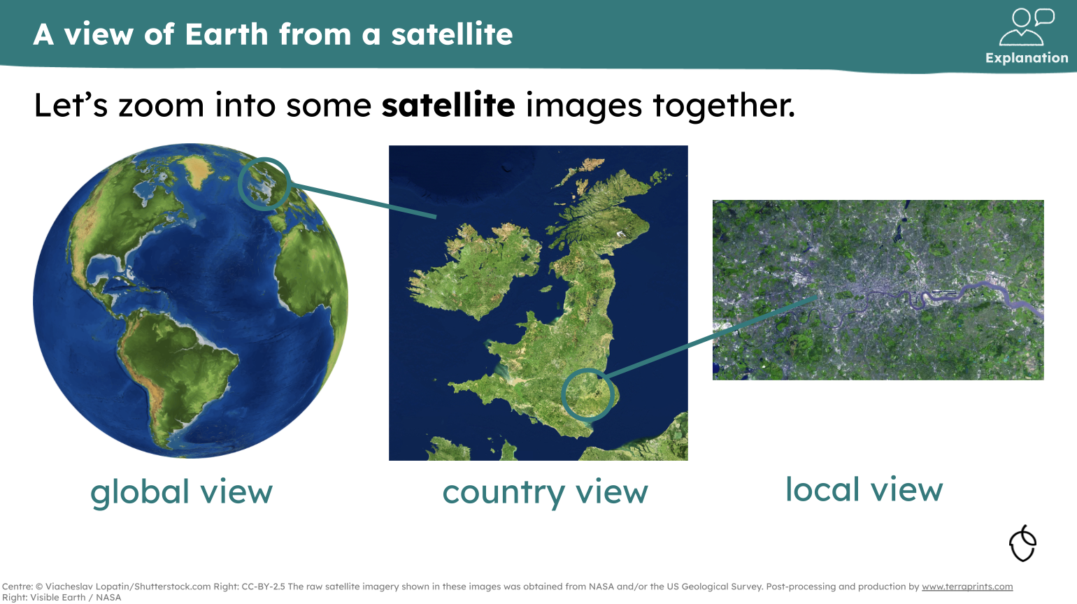
For example, early on in the KS1 resources (the screenshots below are taken form Year 1 Topic 1 Local area: where do we go to school?), children are explicitly taught what an aerial photo is, and that fieldwork does not necessarily take place in a field. This might sound obvious and the sort of everyday facts that we can assume secondary school aged students know. However, many of us will have learnt the hard way that this is an incorrect assumption and so direct instruction of this knowledge is essential. Looking through these resources has given me food for thought about our Key Stage 3 curriculum. What prior knowledge of fieldwork do we know students bring versus what do we need to explicitly teach? Do we explicitly teach what an aerial photograph is and why we use aerial photography as a geographical tool? Do we need to? How do we introduce fieldwork for the first time and is any knowledge assumed that we could teach more explicitly?
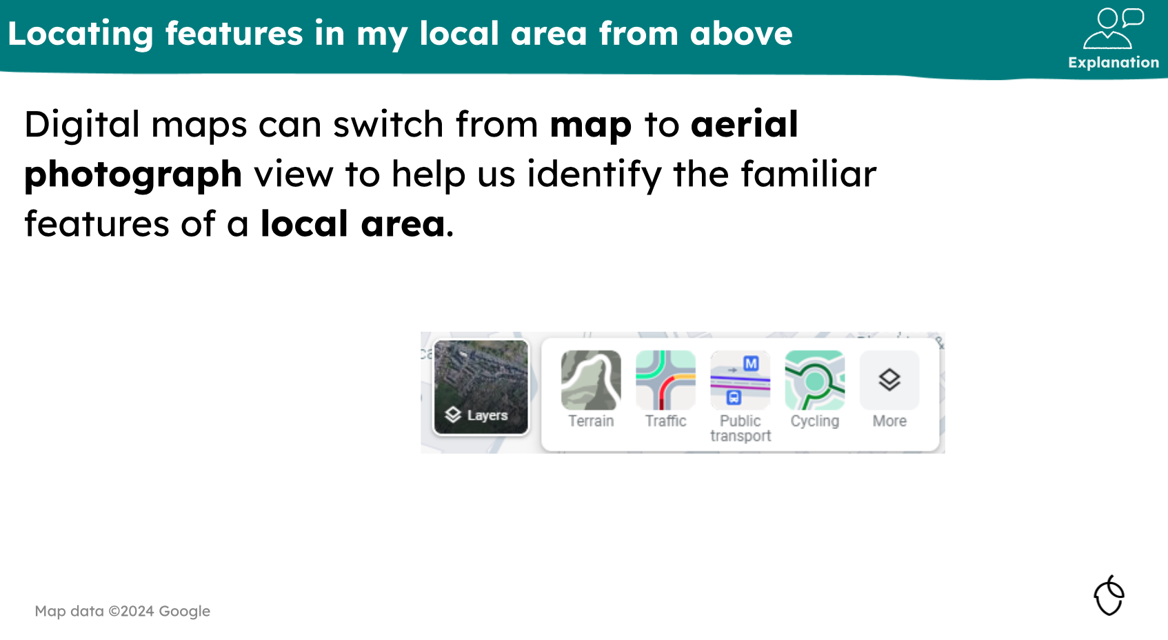
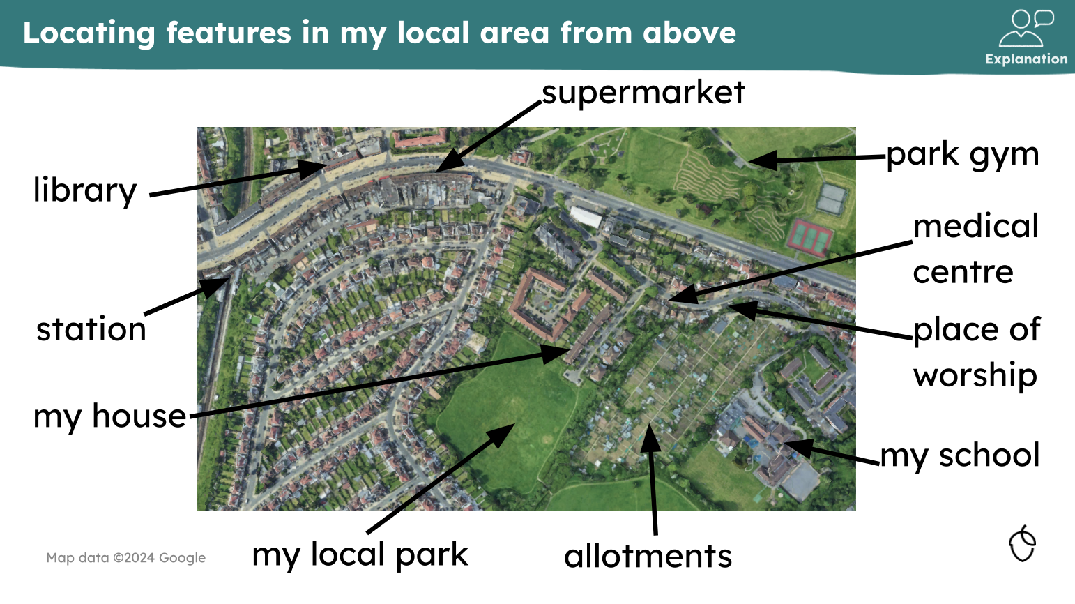
I’ve previously blogged about how we should teach maps and map skills to students in 2025. Deciding what the rich, powerful, geographical knowledge of mapping is today, is paramount. The GA team behind the Oak National resources have clearly done their own careful thinking about this as the screenshots from Year 1 Topic 2 ‘Local Area: where do we live?’ show. In these resources children are taught about mapping as we interact with it today; through online mapping software that seamlessly toggles between OS maps, street maps, aerial photographs, and satellite images. Thinking about the resources I see shared and used amongst the broader geography community, such an approach is still relatively rare amongst those of us who teach KS3. What different types of maps are in our resources and how do these relate (or not) to the maps that students interact with in their everyday lives? Is our everyday use of maps in 2026 reflected in our teaching resources or are they outdated? Do they need to change?
These two (fantastic) topics of Year 1 are followed by a third called ‘Continents and oceans: what can we find out about the world?’. By this point of looking at the resources, the careful curriculum sequencing and golden threads are inescapable. Satellite imagery is revisited and explored in terms of what it shows us about the features of planet earth.
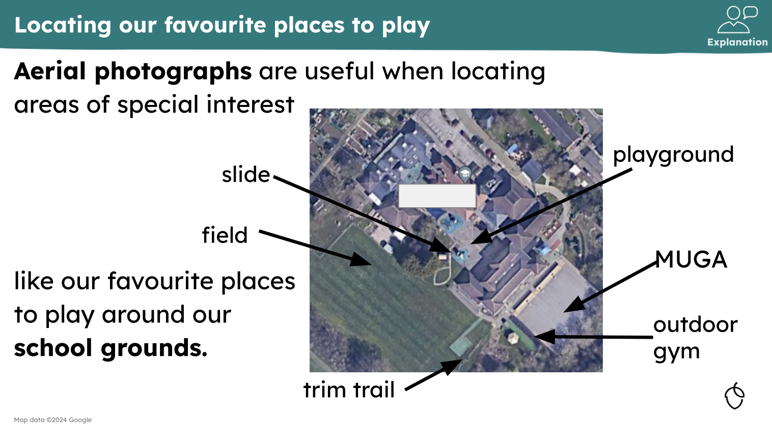
This is again revisited in Year 1 Topic 5 where pupils return to looking at aerial photographs of their local area but, this time, consider how we read maps and plan routes.
So, what can secondary geographers take away from this? Well, many of us will have been guilty in the past of introducing a skill or piece of (disciplinary) once and then not revisiting it for a long time or, sometimes, not at all (one of my main arguments against starting KS3 with a skills unit). Looking through these resources gave me plenty of food for thought about how to overcome this issue. Quite simply, the revisiting of skills and disciplinary knowledge (what it means to ‘do geography’ and the tools a geographer uses) has clearly been mapped out with the same precision as other elements of geographical knowledge. Skills previously introduced are regularly applied to a new context- requiring students to recall their knowledge in order to apply it to a place or use. In doing so, this knowledge is constantly recalled and embedded.
There are plenty more examples I could have included in this blog but hopefully I’ve made it obvious that there is a lot that us secondary geography teachers can learn from the primary resources of the Oak curriculum! It’s well worth making time to look through the KS1 and KS2 resources to see how aerial photographs, satellite imagery and maps are thoughtfully integrated into every topic. It is well worth looking at how fieldwork is introduced and taught and comparing this to your own teaching of fieldwork.
It will be clear that the geographical skills and fieldwork of this curriculum have been planned for genuine progression, as opposed to more superficial exposure that we can sometimes be guilty of and so there is plenty for us to take away and think about in relation to our own curriculums.
Suffice to say that if a student arrived in our Year 7 cohorts with this knowledge and experience of geographical fieldwork and geographical skills, I think we’d been blown away!